 Setting out on trail adventures we often want to go up and see views. But today we decided to take a long loop around to visit Lithia Springs.
 Taking a right at Dry Brook trail we knew it would be a long way. But we had plenty of water and a nice map.
 Glorious sunshine. With no leaves on the trees the light was bright.
 Dry Brook trail was wide. Perhaps it was an old horse cart road? We imagined traveling this road with our cart, carrying vegetables to the market in Granby.
 Our map told us left, the blue blaze, Black Rock trail, would take us up to Taylor's notch. Right, the yellow blaze, Lithia Springs trail, would take us to the reservoir.
“Two roads diverged in a wood, and I -- I took the one less traveled by, and that has made all the difference.” -- Robert Frost
 The Department of Conservation and Recreation did a great job cleaning up after the October snowstorm. Thanks guys!
 We're getting close! Nice shots. Good aim.
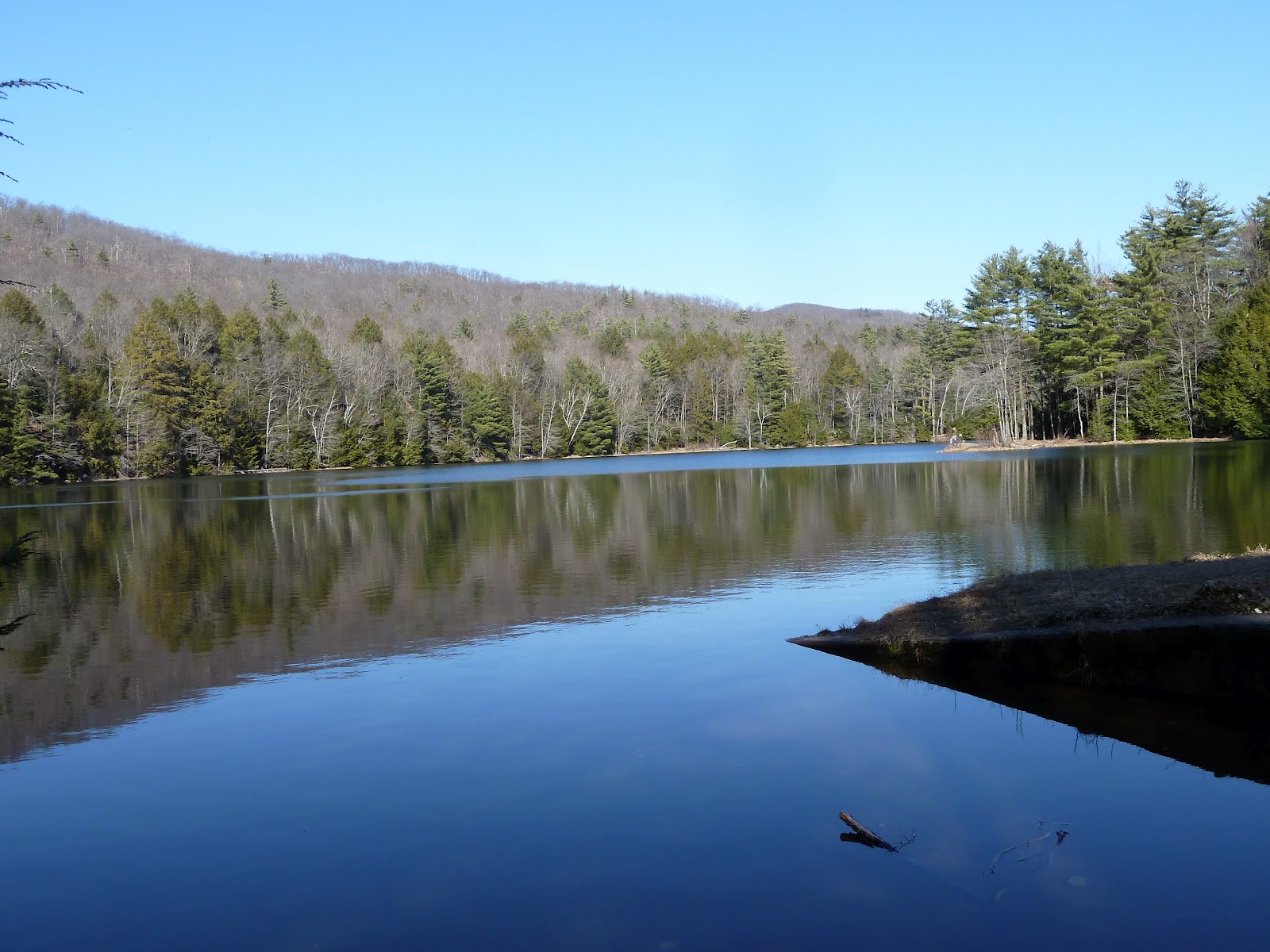 Finally. Lithia Springs Reservior. And we had it all to ourselves.
 We had to cross this small stream so we made a little a step-stone bridge. The rocks were easy to find.
 Author takes time out to wave hello.
 Time to rest and drink some water before the long trek back.
 Decided to take the Lithia Outlook trail back. This way, we'd get some views.
 It's a tough climb. But we still have water!
 Made it to the top! The reservoir sure looks small from up here. Now, time to go home and get some dinner.


2 comments:
I think I'll try reaching it from Lithia Springs road again. "Lithia" does pertain to lithium in the water, which early settlers believed had health benefits. And indeed modern medical science has confirmed that lithium is an important trace element to mental health.
I just did this hike yesterday, thanks for making that rock bridge, it's still there!
Post a Comment